Sightings Pinpoint Validation
A validation function is supplied with Wildlife Recorder which allows you to compare the pinpoint map references in sightings with the geographic area defined for the location selected in the trip . This validation will report those sightings where the following situations are found:
- The geographic area for the location for the trip is a ploygon or a NW/SE coordinate pair and the sighting pinpoint does not lie within the locations geographic area.
- The location position is defined as a single point and the mapref for the trip is more than the user specified distance from the location point.
Using the Sightings Validator:
With the database open, click on Show advanced functions in the left panel.
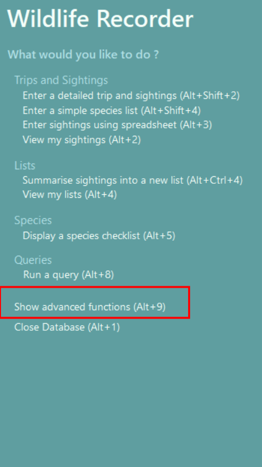
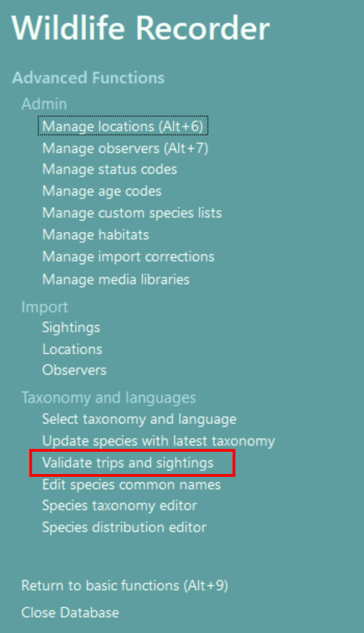
The panel will change, click on Validate Trips and sightings.
An options screen is displayed: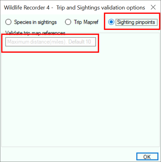
Select the option Sighting pinpoints
Enter the maximum distance you want to allow between the pinpoint and the trip location. The default is 10.
Click the OK button to start the validation.
The validation is performed and the results screen is displayed.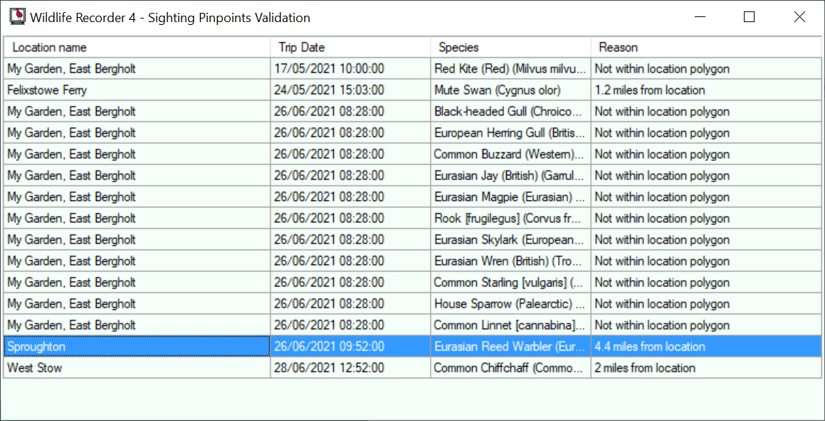
To correct and entry right-click and select the require correction option from the drop-down menu.

Review Pinpoints.
Choose this option to edit the sighting pinpoints using the Sighting Pinpoint Editor.
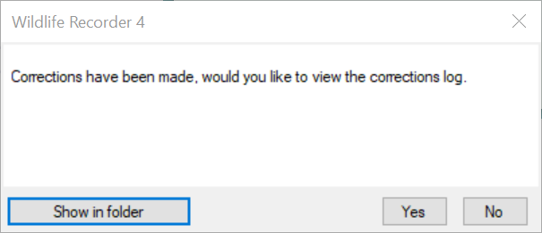
After you request the edited pinpoints be saved, a confirmation message is displayed.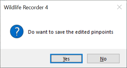
Click Yes to save the change.
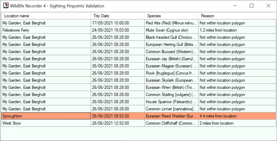
The corrected entries in the list will now be shown with a different background colour to show that they have been corrected.
When you close the validation form you will be given the option to view the corrections log.