List Definition for Area List
This screen is displayed when creation of a new list is requested and the Area option has been selected.
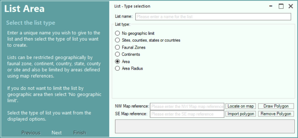
Enter a name you wish to give the new list.
Select the No Geographic Limit radio button if you want to create a list of sightings with no geographic limits
Select Sites, Counties, states or countries radio button if you want to create a list of sightings for one or more selected geographic areas.
Select Faunal Zones radio button if you want to create a list of sightings for one or more selected faunal zones.
Select Continents radio button if you want to create a list of sightings for one or more selected continents.
Select Area radio button if you want to create a list of sightings for an area defined by a north-west and south-east map reference or a complex polygon.
Select Area Radius radio button if you want to create a list of sightings for an area defined by a radius from a central map reference.
An area list can either be for a recantangular area, or a complex polygon.
To create a list for a rectangular area, enter the NW corner and SE corner coordinates or click the Locate on Map to select them from a map (see Selecting the Location from a Map).
A list can be for for an area described by a polygon, the polygon can be created using Bing Maps or can be imported from a GeoJson or KML file created by an external program. (see Polygon Support for Locations and Lists)
To create a polygon using Bing Maps, click the Draw Polygon button. (see Create a Polygon).
To import a polygon from a GeoJSON or KML file, click the Import Polygon button.
To remove the currently defined polgon, click the Remove Polygon button.
Click the Next button or press the Enter key to proceed to next step of list creation.
NB: If the list creation screen is displayed in response to a request to enter a simple species list then only the Sites, Counties, states or countries option will be available.