Polygon Support for Locations and Lists
In older versions of Wildlife Recorder the boundaries of a location could be given as a rectangle defined by a NW and SE corner map reference. Lists could also be created to summarise sightings within an area defined by a NW and SE corner map reference.
Wildlife Recorder has now been enhanced so that an area for a location or list can be described by the use of a multi-point polygon.
Examples:
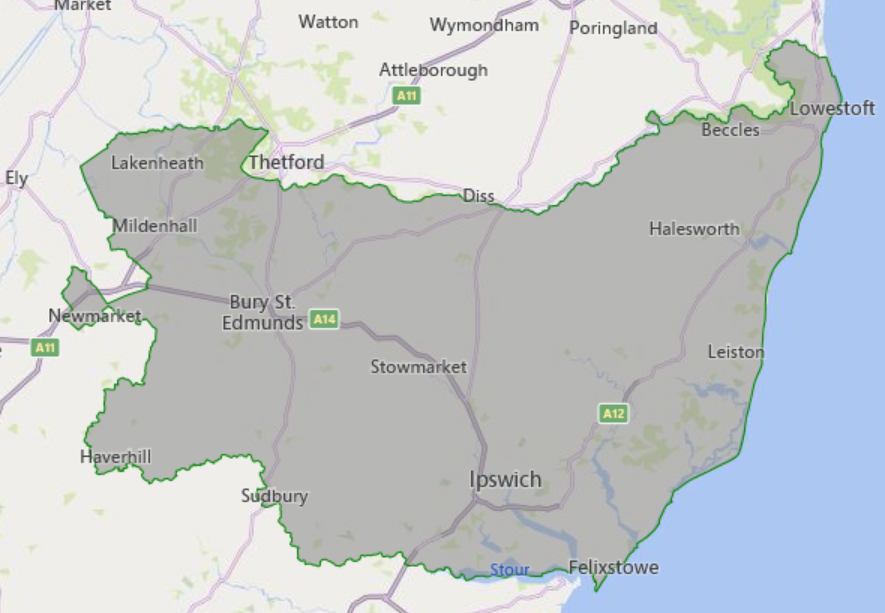
1.County of Suffolk in England
2. Site Minsmere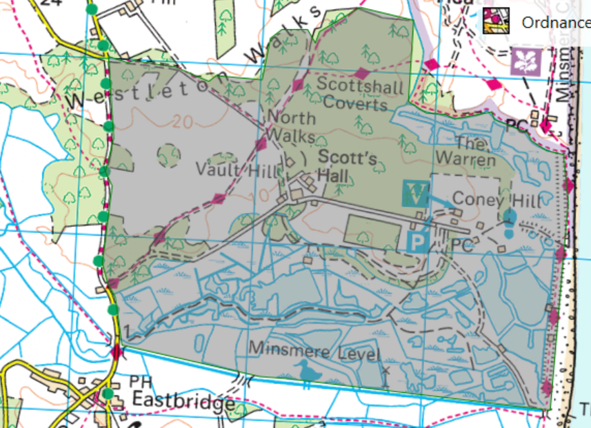
Suitable polygons can be created using external GIS programs like http://geojson.io and Google Maps. Basic facilities for creating polygons are available from within WR4 if you are using Bing Maps as your map provider.
When entering or importing a trip for a location described by a polygon the trip map reference, if supplied, will be checked to ensure that it lies within the boundaries of the location.
See Also:
Create a polygon using Bing Maps